San Diego has arguably the most beautiful weather for outdoor activity all year long. From parasailing to surfing, cycling to running it seems like the people who live in San Diego are always outside and on the go. With the perfect weather and outdoor lifestyle, the hiking scene is out of this world.
Hiking in SoCal includes coastline and desert hikes with a great deal of hills which make for a great and often times challenging adventure. I spent 4 years here exploring the outdoors with my family every chance we got and these 5 hikes are the some of the best, albeit hard to choose just a few hikes with so many to pick. If your visiting San Diego or if you live here I can’t encourage you enough to take 3 hours out of one of your days and get outside and see the beautiful countryside.
General Hiking Pro-Tip: During the summer hike in the morning before the SoCal sun rises to the top of the sky and heats things up. Also, bring plenty of water, it’s a dry climate and you need to keep hydrated. On the longer hikes I always bring Nuun tablets with me to keep electrolytes levels up. Oh and don’t pick up ropes, they might rattle.
Mission Trails Regional Park
Mission Trails Regional Park is a 5,800-acre open area preserve with hiking trails for days. I’m going to focus on 2 of the hikes I enjoy most, Cowles Mountain and Fortuna Summit, but there is definitely a trail for everyone here. If you have time check out the visitors center and support all their great work.
Visitor Center: 1 Father Junipero Serra Trail San Diego, CA 92119
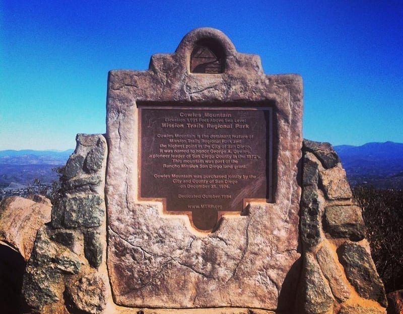
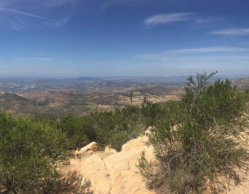
Cowles Mountain
Cowles Mountain is one of the most popular hikes in San Diego. Boasting the highest peak in San Diego County coming in at 1,593 ft. this is a short but steep climb. Once you climb the 1.5 miles of switchback trails to the top you become enamored by the 360-degree view of Southern California, Northern Mexico, and the Pacific Ocean. It is one of the most beautiful scenes I have ever seen.
Pro-Tip: If you can come during the workday there will be fewer people on the trail, it’s popular. Oh! Don’t forget the camera.
Parking/Trailhead/Restroom: 7079-7131 Golfcrest Dr. Santee CA 92071 Restroom located at the trailhead
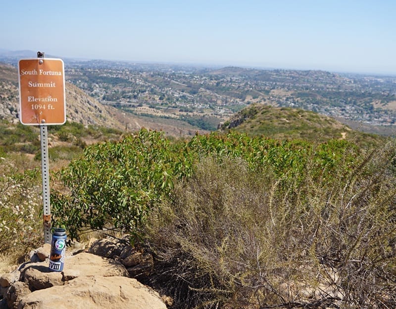
North and South Fortuna Summit via Clairemont Mesa Blvd
As with most hikes in Mission Trails Park the Fortuna Summits can be accessed by multiple locations but by far my favorite is listed below and turns this hike into 6 miles. It starts off the street with a short but steep climb up to the main trail system which flattens out quite a bit for a mile and a half this is where the climb up to the summit begins. Don’t take this trip lightly as it has an intense section of climb. Once you reach the top the trek to the South Summit is fairly light. This is then followed by stair like a climb down the mountain and wraps back where you began. This hike has less foot traffic than the others so be prepared for some extra isolation.
Pro-Tip: Bring some scratch paper and a pencil. There is a box at the top of the summit to toss in a note and read what others have written. And once you’ve completed this hike as described check it out in reverse those stairs are a sick climb up.
Parking/Trailhead/Restroom: 11440 Clairemont Mesa Blvd San Diego, CA 92124
No Restroom on Trail
Iron Mountain Trail
As you walk onto the trail you are welcomed by an old threshold sign that says Iron Mountain. This trail is a hike that I found myself coming back to multiple times. It is a 5-mile hike with a good climb. It also has some shade throughout by the high boulders that are found throughout the hike. Shade is something that is uncommon, however extremely welcome, in the desert hikes of San Diego. It is also a popular hike but I never felt the crowd on this trail. It is nice to see a friendly face every 20 minutes or so to exchange a hello with.
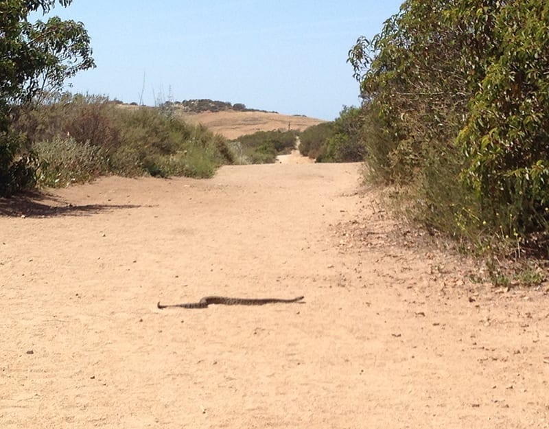
Fun story: This hike is the one where I was able to save my wife’s life, well kinda. We were at the end of the hike and she wasn’t exactly looking at the ground when a rattlesnake was crossing the trail. Lucky for us that I grabbed her and pulled her out of stepping on the snake. After I pulled her away, the snake just kept crossing the trail and completely left us alone as we did it.
Parking/Trailhead/Restroom: 14847-14909 CA-67, Poway, CA 92064
No Restroom on Trail
Pro-Tip: After my story, this is a great chance to mention hiking with at least one additional person. You never know when you’ll want someone to talk to or need someone’s help. Also, nothing brings people closer than some physical activity.
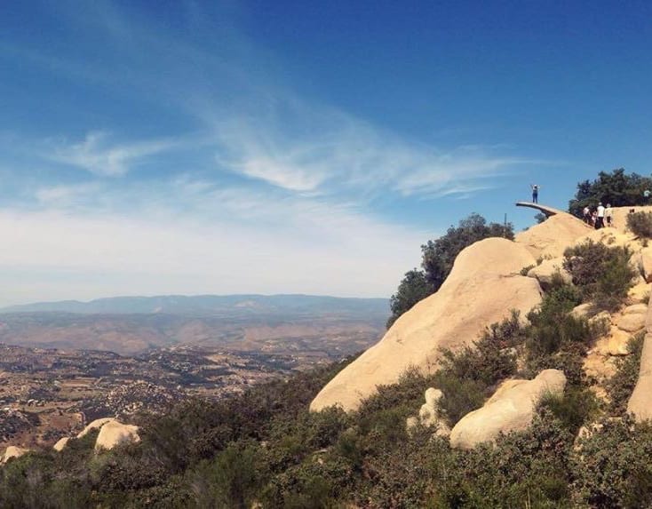
Mount Woodson Trail
Mount Woodson Trail is another hugely popular trail which leads to the famous potato chip rock. This hike is approximately 8 miles round trip and has the standard hilly conditions that most other SoCal hiking does. As your heading up you have some great views and some isolated times that surround you with rocks. It is an absolutely beautiful trail and keeps you engaged to the hike the entire time.
Parking/Trailhead: 14644 Lake Poway Rd Poway, CA 92074
Restroom Located at Trailhead
Pro-Tip: This hike is long and an out and back style, be prepared with water and a little something to snack on. The famous potato chip picture is classic; bring a friend with you to take the picture and leave plenty of time as there is usually a line at the top.
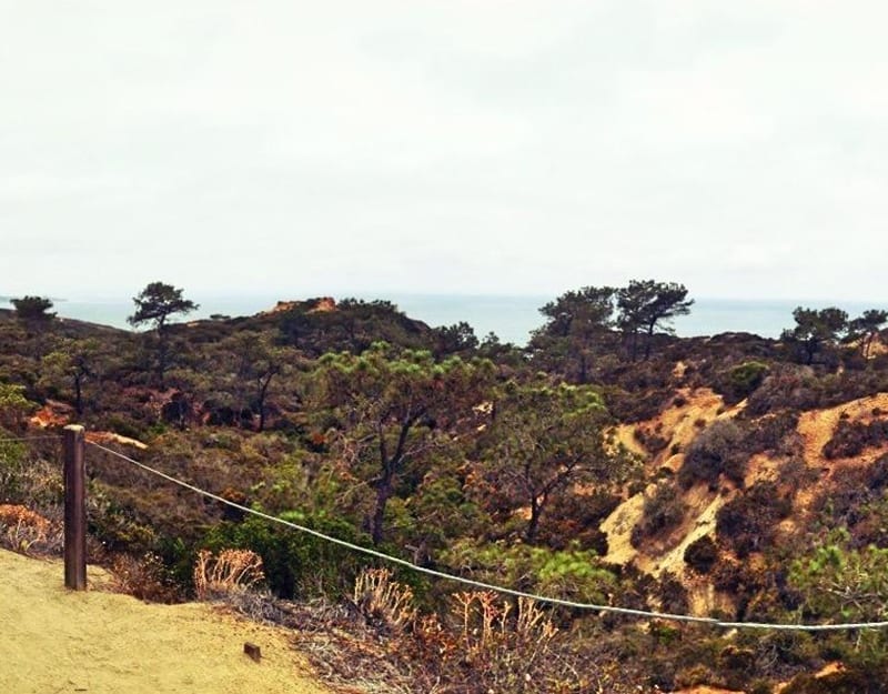
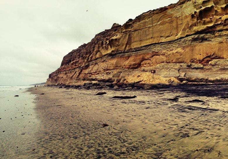
Torrey Pines State Park
Of all the hikes we have mentioned in this blog the Torrey Pines State Park is probably the most friendly hike of them all. It is mostly paved up to the top of the summit of the park with small off-road trail systems throughout. Torrey Pines is directly up against the Pacific Ocean and gives you a beautiful elevated view of the ecosystem that surrounds it. There is even a trail that takes you down to the ocean where you can walk back to your car.
Parking/Trailhead: 12600 N Torrey Pines Rd, La Jolla, CA 92037
Restroom Located at Trailhead and Top of Trail
Pro-Tip: Just because it’s paved doesn’t mean the hills aren’t steep so be ready for a nice climb. Oh, and when you’re done head North on Camino Del Mar to find some fantastic eateries.